











Now Reading: Not all heroes wear capes—some are large metal machines orbiting Earth
-
01
Not all heroes wear capes—some are large metal machines orbiting Earth
Not all heroes wear capes—some are large metal machines orbiting Earth

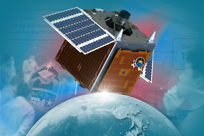
What lurks in the dark ends of the atmosphere remains the hero of our modern life. Neither a bird nor a plane, but an artificial satellite responsible for communication relay, weather forecasting, navigation, and Earth observation; and the Philippines may just have one.
Since the inception of the Philippine Space Agency (PhilSA) in 2019, it is no news that engineers of the agency have concentrated their efforts on space-based solutions to reduce the impact of human-induced disasters and respond to changes in atmospheric conditions with unprecedented precision.
With their recent push as they gear up for the next generation of satellites, the flagship program, Multispectral Unit for Land Assessment (MULA), aims to be the biggest Philippine satellite with extensive capabilities in disaster response and environmental monitoring—a job proven to not only be for Superman.
Man-made ‘man of steel’
Designed and manufactured by 16 Filipino engineers together with British company Surrey Space Technology LTD (SSTL), MULA is a step-up from the previously deployed crucial satellites like Diwata-1 and Diwata-2, in terms of technological capacity and climate observation.
“Proving to be the most advanced homegrown satellite weighing 130 kilograms, MULA will carry a TrueColour camera capable of capturing five-meter resolution images with a wide swathe width of 120 kilometers,” PhilSA said on its website.
Unlike previous satellites, the satellite can cover more ground in each pass, useful for applications requiring frequent updates over large areas for monitoring terrestrial ecosystems, assessing environmental conditions, and disaster management.
This nation-scale monitoring with five-meter resolution means it can identify large topographical landmarks within its range, like roads and large establishments, but not very specific details like recognizing individuals and car license plates.
In addition to these advanced capabilities, MULA will also have nine spectral bands. The way these work is that it enables artificial satellites to differentiate similar-looking features and notice changes in the spread and decrease of features in a certain area, useful for land cover change mapping, disaster and forestry management, and crop monitoring.
“Equipped with the acquired technical know-how and capabilities through our experiences in building DIWATA and MAYA satellites, we are now moving forward with our first operational and industrial quality satellite aimed towards providing a wide range of socio-economic benefits for the country,” PhilSA deputy director-general and Advanced Satellite and Know-how Transfer for the Philippines (ASP) project leader Dr. Gay Jane Perez said.
More powerful than a locomotive
This project, implemented by University of the Philippines Diliman and Department of Science and Technology (DOST)-Advanced Science and Technology Institute in coordination with PhilSA, will also be equipped with the Automatic Identification System (AIS) and Automatic Dependent Surveillance-Broadcast (ADS-B) for ship and aircraft detection and tracking.
ADS-B, an aviation technology system, and AIS, a technology system used by marine vessels, help monitor real-time global traffic. When built in the satellites, tracking aircraft in remote areas or areas with no radar stations will be possible, while port traffic control will be enabled and collision avoidance in the ocean will be avoided.
“We will be able to better monitor terrestrial ecosystems, as well as our land and marine resources to ensure both agricultural productivity and environmental integrity,” Dr. Perez said.
Through the advanced features of the MULA, key sectors believed it would enable proactivity in disaster management and mitigation, hence providing a wide range of socio-economic benefits for the country.
It is worth noting that the Philippines was ranked as one of the most climate-vulnerable countries by the 2024 World Risk Index, annually losing 1.2 percent of gross domestic product (GDP) to typhoons alone. This translates to an estimated $5.64 billion in 2024 from damage to infrastructure and loss of income due to lower labor productivity and agricultural production, as well as changes to consumption patterns.
The loss occurs despite the fact that the government spent almost Php 2 trillion for Disaster Risk Reduction and Management (DRRM) from 2015 to 2022; allocating Php 444.0 billion or 23 percent on disaster management; Php 418.4 billion or 21 percent on disaster mitigation; and Php 714.2 billion or 37 percent on disaster prevention.
World Bank has predicted that by 2030, the costs of climate change-related disasters would balloon to 7.6 percent of the country’s GDP or an estimated amount of Php 1.4 trillion.
“As climate change intensifies disaster risks, integrating technologies like AI and space-based systems into our DRR [disaster risk reduction] strategies is vital for a safer, more resilient future. APMCDRR [Asia-Pacific Ministerial Conference on Disaster Risk Reduction] serves as a platform for collaboration on solutions that protect both people and the environment,” Environment secretary Maria Antonia Yulo-Loyzaga said.
Up, up, and away!
Through its collaborations with international space organizations such as the National Aeronautics and Space Administration (NASA), Japan Aerospace Exploration Agency (JAXA), and the European Space Agency (ESA), on MULA development, the Philippines contributes valuable data to global initiatives in shaping climate adaptation policies while building relationships with space-adjacent companies in the country.
Furthermore, in a statement from the Presidential Communications Office (PCO), the satellite is expected to be launched in the US between October 2025 to March 2026 using SpaceX Transporter-16.
“In the Philippine space policy, it is written that we have a central goal of becoming a space capable, spacefaring nation within the next decade. So, being spacefaring means you have people think of astronauts, right, but satellites are kind of a proxy for astronauts,” PhilSA Director General Joel Marciano Jr. said on using satellites as the forefront of space technology development.
As the government seems to focus now on tech-based solutions and steers away from band-aid fixes it has since relied on, a homegrown “man of steel” in the form of MULA emerges as a promising ally in addressing disaster resilience and response of the country—proving not all heroes wear capes.